
Multidisciplinary measurement, data collection and evaluation services needed for underground imaging studies
Capabilities of Earth and Marine Sciences Institute:
- Determination of coal spread and detection of buried fault-lines and underground discontinuities directly affecting mine operation plans
- Investigation of structures of cultural heritage such as archaeological remains, historical cemeteries, tunnels, caves and sinkholes
- Non-destructive detection of pipelines and engineering structures in residential areas
- Determination of geothermal system potential before and after operation, reservoir determination and monitoring of re-injection fluid flow direction and relevant seismological activity
- Combined and multi-disciplinary use of magnetotelluric, seismic, seismological, gravity, remote sensing, magnetic, GPR and downhole geophysical methods, and Two/Three Dimensional Modeling
Products:
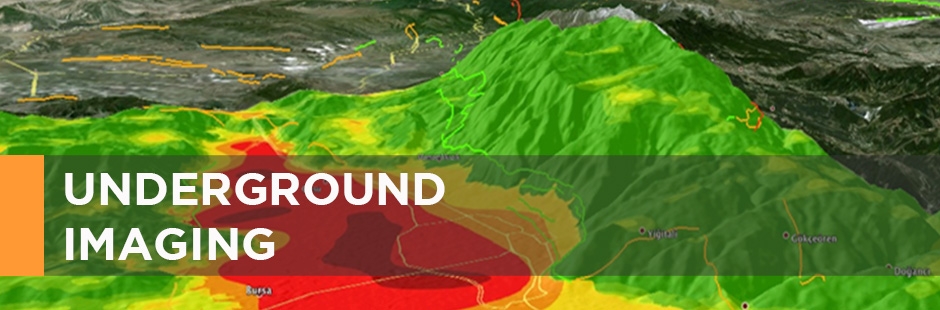
- Shallow/Deep Underground Image Maps
- Distribution of underground discontinuities
- Distribution maps of small earthquakes
References:
• Many research projects have been conducted to determine reserve amounts and limits of major lignite basins in Turkey such as Soma, Afşin-Elbistan and Orhaneli.
• Multidisciplinary studies have been conducted in Konya-Karapınar region for determining sinkholes.