TUBITAK, Turkey's flagship in science and technology, has been working for 61 years to make our country prepared for disasters. Turkey is becoming more prepared for the earthquake reality with our high-tech steps that have increased recently. Under the coordination of the Ministry of Industry and Technology, TÜBİTAK continues its earthquake studies in a multi-dimensional manner.
TÜBİTAK BİLGEM Disaster Management Program
TUBITAK has gathered these state-of-the-art studies under the umbrella of a program and established the TÜBİTAK BİLGEM Disaster Management Program. This program aims to work on technologies that can be developed to help disaster victims and search and rescue teams before and after disaster events such as earthquakes, fires and floods. Within the scope of this program, AkuSTECTS, CANDORA, ATEAS and ARİT projects are being carried out.
Wreckage searches will become easier with AkuSTECTS
Acoustic Seismic Sensor Based Live Detection System Under Debris (AkuSTECTS) project Within the scope of the project, a prototype product that can be used with acoustic and seismic sensors to detect whether there are any living people under the rubble has been created. This system, developed for the first time in Turkey, has only two equivalents abroad.
The prototype product consists of three geophone sensors, an acoustic sensor, a headset and an operator panel to display the signals received wirelessly from all sensors on the user interface. The operator panel communicates wirelessly with the geophone sensors.
The prototype system was tested in the debris field and proved to be functional in different scenarios. In particular, it was tested that the seismic sensor (geophone) application can be successful in the debris and even has higher sensitivity compared to the equivalent system.
The aim is to redesign the prototype product on the basis of electronic circuits to make it suitable for environmental tests and to produce a product ready for mass production and delivery to the potential customer organization. Discussions are ongoing with AFAD to expand the Akustects project.
Doppler Doppler Radar for Under Rubble Live Detection (CANDORA)
As a result of the studies conducted at TÜBİTAK BİLGEM, a prototype radar system capable of detecting the presence of living beings under rubble has been developed. The working performance of this radar prototype was verified through experiments conducted in the laboratory environment and test studies conducted in the debris environments of search and rescue teams such as AFAD and municipalities. The prototype radar system was placed on or around the debris and it was observed that the system could detect whether there were any living beings in or under the debris. According to the experimental studies, the prototype radar system can detect minor movements such as breathing and limb movements such as hand and arm movements. It can also provide information about the location of the living being. In addition, thanks to the technology used and the basic parameters of the system, it is evaluated to have more effective penetration capability and high range resolution compared to its counterparts.
Smartphone Debris Search System (ATEAS)
The project aims to determine the status and location of disaster victims trapped under rubble by communicating with the mobile application on their smartphones. The system envisages live detection when the GSM network is inoperable.
Two mobile (Android) applications were designed within the scope of the project. One application is the IMDAT application used by disaster victims and the other application is the YARASA application designed for Search and Rescue teams.
Imdat App is a mobile (Android) application that sends information about the victim's situation in different ways for situations such as earthquakes, heart attacks, kidnapping and stalking. In the event of an accident/disaster, it sends location information to the phone numbers previously registered in the application via GSM with a single button. If there is no GSM access in case of an earthquake, the application switches to listening mode and analyzes the acoustic signals it receives from the environment and communicates with the Bat application. The application also sends acoustic signals in transmitter mode, which contain the necessary messages to determine the information of the disaster victim, his/her vitality status and how far he/she is from the person using the Yarasa application.
The Bat App is a mobile (Android) application that allows to detect and communicate with people under rubble and determine how far away the disaster victim is. With the "Trigger" mode in the Bat App, an acoustic signal containing a trigger message is sent and the disaster victims under the rubble are listed by receiving the responses from the Help applications under the rubble. With the "Communicate" mode, the vitality status information of each disaster victim under the rubble is received. With the Proximity Measure mode, the distance of the disaster victim is determined according to the intensity of the signal coming from the Help application on the disaster victim's phone. According to the received signal level, the exact location of the disaster victim is determined by means of markings on the debris pictures.
The development work of both applications has been completed and performance tests were carried out in the debris.
Disaster Risk Monitoring and Forecasting System (DRMTS)
The aim of the project is to establish a system that enables real-time processing of various data sources related to disasters such as earthquakes, floods, landslides, etc. and prediction of disaster risks with the help of artificial intelligence techniques. The system is designed to operate as a continuous service, scalable and adaptable for different types of disasters.
In the smart measurement stations to be established within the scope of the project, data measurements will be made continuously through sensors such as Electrostatic Rock Strain (ECG), Meteorological sensors and Seismometer. The measured sensor data and external data such as geodetic strain and deformation, satellite-observed magnetic flux (MF) and air temperature will be stored synchronously in the data centers to be established in ITU and TÜBİTAK thanks to the replica data processing/management system.
After the collected data are pre-processed and labeled for the identified disaster types, they will be used in the training of predictive artificial intelligence models such as PECNET, RNN and LSTM. With the trained artificial intelligence models, the risk of occurrence of the identified disasters in a certain time window will be instantly estimated and risk indices will be created.
The risk indices envisaged by the observation and warning service system will be continuously monitored and used to decide the risk level of a disaster together with the defined conditions. In case the risk of a disaster exceeds the specified threshold value in any region, warning notifications will be made to the designated centers.
Once the system is up and running and capable of making successful predictions,
- It will reduce the loss of life and property due to natural disasters.
- Thanks to the development of a scalable data collection and processing system, it will be possible to use the infrastructure for disaster risk types such as earthquakes, floods, agricultural risks.
- Critical data on disasters will be collected for a long period of time, more than 10 years.
- The raw and/or processed data collected will be shared with various universities and research organizations to support research for various purposes, especially disaster prediction.
Creating seismic hazard and damage distribution estimation maps according to earthquakes
Since 2000, we have carried out projects on seismic hazard and landslide hazard with the municipalities of Yalova, Kocaeli, Bursa, Istanbul, Balıkesir, and İstanbul in the field of Seismic Hazard and Soil Classification at the provincial scale. In the Gaziantep Province Seismic Hazard Assessment project, which was initiated in 2020 within the scope of earthquake master plan preparation studies, we continue to work on creating seismic hazard and damage distribution estimation maps according to scenario earthquakes, taking into account building and infrastructure characteristics.
DEPAR Project
Within the scope of the Emergency Post-Major Earthquake Observation Research (DEPAR) project, we deploy to the region immediately after a major earthquake in any region of our country and record aftershocks with temporary seismological observation networks surrounding the epicenter of the earthquake as soon as possible. With the data collected from seismological networks, we continue our efforts to identify active faults in the region and reveal the potential earthquake hazard threatening residential areas and large investment facilities. Finally, with the studies we carried out after the February 6 Kahramanmaraş Earthquakes, we continue our studies in the region in order to determine the locations of the aftershocks occurring in the region with high precision, to reveal the fault segments they are related to and the working mechanisms of these segments in detail, and to monitor deformations in real time.
136 seismology stations installed
The NSF (National Science Foundation) RAPID project, which we realized in cooperation with TÜBİTAK MAM, University of Missouri and Georgia Tech, started in May with the installation of 136 seismological stations in the area covering the provinces of Malatya, Adıyaman, Kahramanmaraş, Kayseri, Osmaniye, Adana, and Hatay. Our earthquake monitoring efforts continued with 72 additional stations installed in July to conduct detailed investigations along the fracture zone. Field studies were completed in September 2023. Within the scope of our work, the data collected with the state-of-the-art measurement systems used in the region will enable the earthquake parameters to be determined with high precision and the seismic activity in the fault systems to be revealed in detail thanks to near-field measurements. We continue to work on determining earthquake parameters with high precision by including the data of stations close to the region operated by the seismological networks of AFAD Earthquake Research Department and Boğaziçi University Kandilli Observatory and Earthquake Research Institute (BÜ-KRDAE). The data collected by such a dense seismological network is analyzed using artificial intelligence algorithms, evaluated by our experts and thus earthquakes can be detected with high precision. These studies provide important information such as fault mechanism solutions, stress distributions, distribution of seismic gaps and energy transfers.
Our prominent projects:
- The Kahramanmaraş and Hatay earthquakes once again demonstrated that air transportation plays an indispensable role in disaster management and emergency response. With the project created within this framework, studies are carried out to determine the earthquake hazard at airport sites and to monitor ground parameters in cooperation with TÜBİTAK MAM and State Airports Authority in order to ensure the sustainability of the operation of airports.
- Within the scope of the October 30, 2020 Studies to Determine the Geoscientific Characteristics of the Izmir Bornova Basin, which was Most Affected by the Izmir Earthquake, multi-channel seismic reflection data were collected in Bayraklı and Bornova districts, and the structural properties and geometry of the rock stack in the Bornova Basin, as well as the faults and discontinuities buried underground in the region were imaged with the seismic images obtained along the determined lines. The seismic study, which was completed in a densely built-up and populated area, is the first of its kind in Turkey and one of the few similar studies in the world.
- In Muğla province, we continue our studies for the identification of live faults and determination of seismic hazard in the area between Ula-Akyaka.
- Turkey's first and only Accelerated Mass Spectroscopy (AMS) Laboratory, which can perform Carbon-14 age determination of earth, marine, environmental sciences and archaeological samples, ending our foreign dependence on this subject, has been continuing its activities since 2016. Thanks to the carbon-14 age determination analysis carried out in the TÜBİTAK MAM AMS Laboratory, light is shed on historical earthquakes up to 50 thousand years ago, and our cultural assets and historical artifacts are prevented from going abroad.
- The groundwork needed for the ground license for the Sinop Nuclear Power Plant was produced with geoscientific investigations, and the groundwork for the Akkuyu Nuclear Power Plant was completed. We continue to monitor the earthquake activity at the Sinop Nuclear Power Plant Site with established earthquake monitoring networks.
- Within the scope of the project to improve the Earthquake Research infrastructure of the Pakistan Meteorology Department, our Pakistani colleagues were trained in different geoscience disciplines. Theoretical and practical knowledge transfer was provided with the trainings held in TÜBİTAK MAM and Islamabad.
- Within the scope of the 25-year Marmara Region Earthquake Monitoring Network, monitoring of seismic activity continues and information is provided on the mechanisms of seismic movements and seismic activity of live faults for the earthquake hazard in the Marmara Sea.
Other projects carried out by TÜBİTAK MAM YBAG in the last 20 years can be found below:
- Emergency Observation Research after a Major Earthquake (Depar-II)
- Gaziantep Province Seismic Hazard Assessment Project
- Corporate Resources B.U. Ltd. Investigation of the Relationship between Drilling and Blasting Seismic Activities and Earthquake Activity in the Region-II
- Investigation of the Relationship between Marsa-Çanakkale Operation Drilling and Blasting Seismic Activities and Earthquake Activity in the Region
- Corporate Resources B.V. Ltd. Şti. Ankara Turkey Branch Investigation of the Relationship between Drilling and Completion Seismic Activities and Earthquake Activity in the Region
- Soil Classification and Seismic Hazard Assessment in Balıkesir Province
- Investigations on Site Assessment Parameters for Sinop Nuclear Power Plant
- Investigation, Investigation and Monitoring of Various Landslide Sites in Beylikdüzü and Büyükçekmece Districts
- AB-New Directions In Seismic Hazard Assessment Through Focused Earth Observatıon In The Marmara Supersite
- Ensuring the Continuity of Multidisciplinary Observations in High Earthquake Risk Regions of Turkey
- Seismotectonic Properties of The Eastern Aegean: Implications on The Stress Field Evolution and Seismic Hazard Assessment In A Tectonically Complex Area
- AB-Black Sea Hazard Network
- Soil Classification and Seismic Hazard Assessment for Bursa Province
- AB-Processing Russian and European Earth Observations for Earthquake Precursors Studies
- Investigation of Potential Resilient Faults and Priority Landslide Areas in Istanbul Land Area and Development of Detection and Monitoring Methods
- Seismokul - Seismology in Schools Project
- Updating the Seismicity Observation Infrastructure Capacity in the Marmara Sea
- AB-Scenarios For Hazard-Induced Emergencies Management
- Investigation of Earthquake Behavior in Geo-strategic Regions of Turkey with High Earthquake Risk by Multidisciplinary Approaches
- Soil Classification and Seismic Hazard Assessment for Kocaeli Province
- Microseismicity of Sinop Nuclear Technology Center Site
- Monitoring the Earthquake Activity of the Marmara Region with Multidisciplinary Methods and Investigating the Possible Effects on the Ground of Istanbul Coastline / Continental Shelf
- Post-Earthquake Emergency Observation Research
- Microdeformation Characteristics of the Region between Gebze and Tuzla
- Operation and Development of the Earthquake Station Network of IMM Soil and Earthquake Investigation Directorate
- Earthquake Prediction Studies with Radon Gas and Other Methods in Marmara Region
- Turkey-Israel Seismological Network Calibration
- Determination of Marmara Sea Crustal Velocity Structure from Seismarmara-2001 Data
- Monitoring the 1999 Izmit-Duzce Earthquakes Deformation Cycle
- Earthquake Prediction Studies in Marmara Region
- Calibration of the Anatolian-Arabian Plate by Seismic Refraction Method
- Seismic Zoning and GIS Studies for Yalova Settlement Center
- Emergency Monitoring Studies for Earthquake Risk in Marmara Region and Istanbul Metropolitan Area
- Determination of the Dynamic Properties of the Western and Central Segments of the North Anatolian Fault
- Implementation of New Methods for Earthquakes in the Marmara Region
- Ensuring Seismological Data Quality and Continuity
- Seismicity of the Kazan Trona Deposit Area
- Tsunami Risk in Marmara Sea
- Testing Some New Methods for Earthquake Monitoring in the Marmara Region
TÜBİTAK also continues to support earthquake studies.
1001-Earthquake Research Call
A special call titled "1001-Earthquake Research" was launched due to the need for research on the risks and effects of earthquakes, which can cause sudden and devastating physical damages as well as economic, social, environmental and psychological losses, covering pre-earthquake, earthquake and post-earthquake periods. 80 projects were supported within the scope of the "Call for Earthquake Research" opened on 15.02.2021.
Special Call for Earthquake Region Universities - BINBIRÇABA
On March 1, 2023, "Special Call for Universities in Earthquake Region - BİNBİRÇABA" was opened within the scope of "1001-Scientific and Technological Research Projects Support Program" to support the R&D activities of our researchers living in Hatay, Kahramanmaraş, Adıyaman, Adana, Diyarbakır, Elazığ, Gaziantep, Kilis, Malatya, Osmaniye and Şanlıurfa provinces affected by the earthquake disaster on February 6, 2023 and to minimize the impact of the earthquake disaster on the research ecosystem in the relevant region. Within the scope of support programs for academia and the public, 1,499 project applications were made with the "Special Call for Earthquake Region Universities - BİNBİRÇABA". 245 of these projects were decided to be supported.
TUBITAK 1007- Turkey Paleoseismology Research Project
In the Project for the Determination of Paleoseismological Characteristics of Turkey's Resisting Faults, which is supported under the TÜBİTAK 1007 Public Institutions Research and Development Projects Support Program and carried out under the management of TÜBİTAK MAM, AFAD and MTA are the institutions in need, and the Union of Municipalities of Turkey is the organization that will encourage the implementation of the project results by local governments. The project was put into effect as of 01/09/2023. There are more than 100 researchers and 90 scholarship holders from 22 universities, 14 of which are project executing organizations, AFAD and MTA. Our scientists will determine the geometries of the live faults, the recurrence periods of earthquakes in the relevant fault segments, the dates of the last surface rupture, slip velocities and information on the average amount of slip in each earthquake with the most up-to-date methods and analyzes to be carried out in the internationally standardized TÜBİTAK MAM AMS Laboratory, which we ensure sustainability with our own resources. With the studies to be conducted, earthquake scenarios that may affect residential areas in the regions where live faults are located will be revealed. This study, which will contribute to the development of the databases of institutions, will be an important data source to be used in updating the Earthquake Hazard Map of Turkey created by AFAD. The scientific outputs to be obtained with the established platform will enable the most realistic prediction of earthquakes, which are a danger factor in reducing earthquake hazards and risks and building the infrastructure of disaster-resilient cities, before they occur. It will provide data that will enable the minimization of earthquake damages that settlements will suffer against possible destructive earthquakes in regions with high population density.
UDAP Special Call for Disaster Risk Reduction Research
It was planned to organize a joint earthquake call with a co-financing model between TÜBİTAK and AFAD and within the framework of the cooperation protocol signed between the two Institutions, a special call titled "1001-UDAP National Earthquake Research Program Joint Call" was opened. The deadline for completing the online application is April 1, 2024, and the deadline for the electronic signature of the projects whose online application has been completed is April 4, 2024.
We Will Work Together and Achieve Together Program (BİÇABA) Program
In order to enable undergraduate, graduate and postdoctoral students and postdoctoral researchers affected by the earthquakes to take part in research projects conducted or supported by TÜBİTAK, the We Will Work Together and Succeed Together Program (BİÇABA) was opened for call. Within the scope of the call, 1,317 undergraduate students, 648 graduate students, 419 doctoral students and 99 postdoctoral researchers were eligible for support. As of January 1, 2024, the scholarship amounts have been increased and undergraduate students continue to be supported with 4,000 TL per month for 6 months, graduate students with 13,500 TL per month for 12 months, PhD students with 20,000 TL per month for 24 months and Postdoctoral Researchers with 27,000 TL per month for 12 months.
In order to enable our researchers, who continue to work on the earthquake disaster we are experiencing, to collaborate with international researchers, 13 researchers were supported with the 2221 Guest or Sabbatical Scientist Support Program Earthquake Call.
In order to support researchers who want to participate in scientific activities to be organized abroad on earthquake-related topics, 2224-A Program for Supporting Participation in Scientific Activities Abroad - Earthquake Special Call was opened and 38 people were supported.
In order to support researchers who want to participate in scientific activities to be organized in Turkey on earthquake-related topics, 2224-B Program for Supporting Participation in Domestic Scientific Activities - Earthquake Special Call was opened and 13 people were supported.
In order to support scientists who want to organize face-to-face or online scientific training events on earthquake-related topics, 2237-A Scientific Training Activities Support Program - Earthquake Special Call was opened and 49 events were supported.
We stand by our earthquake researchers
2247 A The researcher, who received support for his project titled "Formation and Evolution of the Anatolian Lithosphere based on Geophysical Data" with the 2020 call of the National Leading Researchers Program, works at "Istanbul Technical University Eurasian Institute of Earth Sciences".
Within the scope of 2232 - International Leading Researchers Program, the researcher supported with the project titled "Spatiotemporal evolution of North Anatolian Fault Zone: Combined geochronological (K-Ar, Rb-Sr, U/Pb, and U-Th) evidence" and successfully completed his studies at Istanbul University.
2232 - The researcher, who was supported with the project titled "Machine learning applications in physics" with the 2018 call within the scope of the International Leading Researchers Program, continues his studies at "Boğaziçi University".
2232 - The researcher, who was supported with the project titled "Novel mapping of upper mantle characteristics in Turkey" with the 2018 call within the scope of the International Leading Researchers Program, continues his studies at Boğaziçi University Kandilli Observatory and Earthquake Research Institute.
We went public
TÜBİTAK once again demonstrated its support for open science and opened its earthquake studies to the public. In 2021 and 2023, two major events were organized.
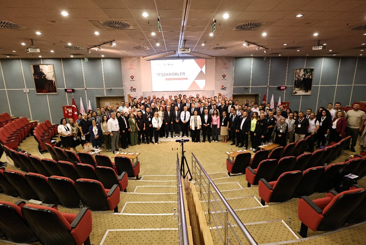
In order to share the supported projects with the public, the Earthquake Research Call Projects Virtual Conference was organized on 29.12.2021. At the conference, the projects were presented by our executives with 11 sub-sessions under the titles of "Multidimensional Earth Science Research", "Digital Technologies for Earthquake Engineering", "Socio-Economic and Social Widespread Effects of Earthquake", "Engineering Solutions for Architectural Designs" and "Innovative Construction Models and Use of Advanced Material Technologies".
In 2021, within the scope of the "Call for Earthquake Research" opened under the "1001-Scientific and Technological Research Projects Support Program" and within the scope of the 1002-C Natural Disasters Focused Fieldwork Emergency Support Program, which was opened on 06.02.2023 after the February 6 earthquakes, an event was organized to evaluate the progress made in the projects supported so far, to plan future studies and to increase the interaction between the projects, and to share the findings, goals achieved and anticipated contributions of the supported projects.